Cross Kouri Bridge with blue water on either side, then leave time for the island beyond the bridge. This guide helps you choose a beach, find the viewpoint you actually want and fit Kouri into a comfortable northern Okinawa day.
For Kouri Island things to do, start with the bridge, beach views and a realistic route through northern Okinawa. Choose stops to suit your group rather than filling every hour.
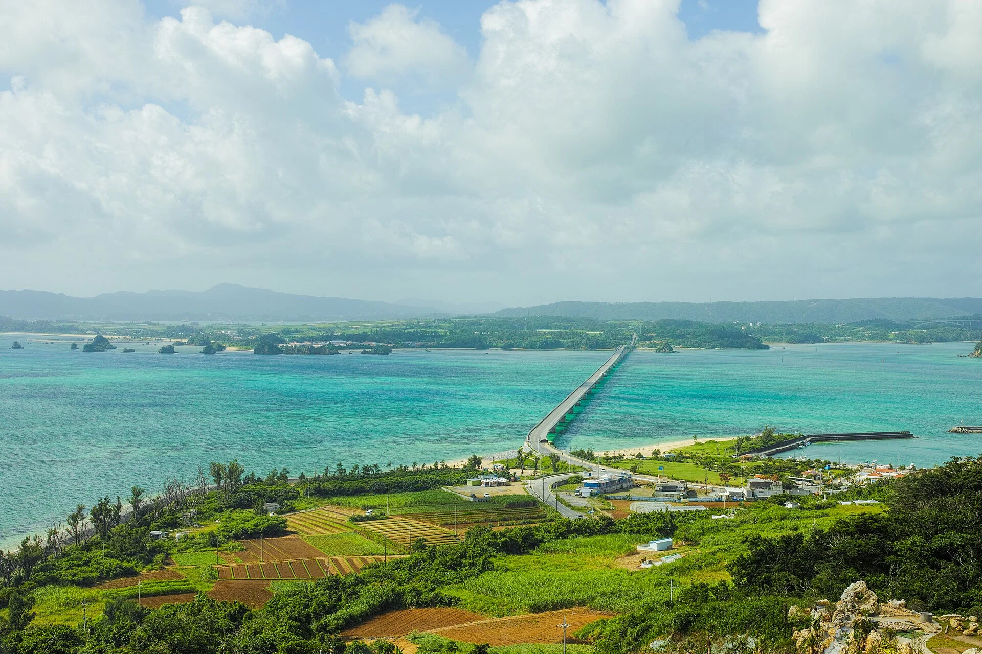
A BRIDGE, THREE AREAS TO EXPLORE
For a first visit, our suggestion is 3–4 hours on Kouri Island for a beach walk, Ocean Tower, a north-coast stop and a meal. For a brief introduction, allow 60–90 minutes around the bridge and Kouri Beach. These are editorial visit allowances; add the journey from your hotel separately.
Practical sources checked on October 16, 2026. Photographs are licensed documentary images from the dates given in their captions. This is a planning guide, rather than an account of our own visit.
Where is Kouri Island, and how long should you stay?
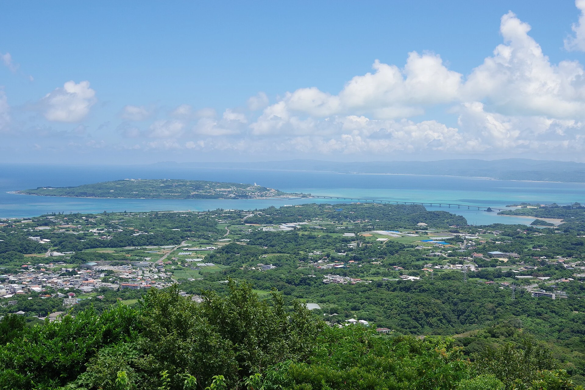
Kouri Island, also written Kourijima, belongs to Nakijin Village in northern Okinawa. You reach it by road through Yagaji Island, so a visit does not require a ferry booking. Its compact size makes a short sightseeing stop possible, while a longer visit lets you explore the shore, viewpoints and places to eat at an easier pace.
The official Okinawa destination guide describes a drive around the island of about 15 minutes. Treat that as a description of the loop, rather than a complete sightseeing itinerary. Parking, walking down to a beach, visiting the tower and having lunch take additional time.
| Time available on and around the island | A reasonable focus | What to leave for another visit |
|---|---|---|
| 60–90 minutes | Bridge scenery, Kouri Beach and a short refreshment stop. | The tower and north-coast beaches. |
| About 3–4 hours | A beach walk, the tower, Heart Rock and a meal, adjusting the order to your transport. | A long swim or several additional attractions. |
| Most of a day from a northern base | A slower island visit, a booked marine activity or an extended meal, with a flexible return. | An ambitious circuit of distant Okinawa sights. |
These are our planning suggestions. A party with a stroller, limited mobility or a long lunch will need a different pace. If you are starting in Naha, the driving or bus journey belongs outside these visit blocks.
Save the south, southeast and north as separate places
A map pin for “Kouri Island” is too broad for meeting a driver or choosing a bus stop. Save the places you want to visit individually. The following orientation table links to map searches; confirm the specific entrance or parking area when you arrive.
| Area | Places to save | Why it matters |
|---|---|---|
| South: the bridge entrance | Kouri Beach and Sorahashi. | A practical starting area for the beach, food and the named Sorahashi bus stop. |
| Southeast: the elevated viewpoint | Kouri Ocean Tower. | A separate paid attraction with its own entry route. |
| North: rock formations and natural shore | Heart Rock at Tinu Beach and Tokei Beach. | Different beach access points, rather than an extension of the bridge-side beach. |
Kouri Bridge: crossing the water and choosing a viewpoint
The bridge links Yagaji Island with Kouri Island. Sorahashi’s visitor information gives its length as 1,960 metres and dates its opening to 2005. You can enjoy the changing colour of the water during the crossing, then look back at the bridge from the island shore.
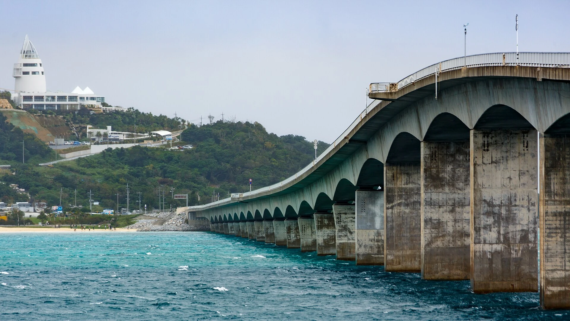
Decide whether you want a beach view or an elevated panorama
From the beach area, the bridge is close and the water fills much of the scene. From Ocean Tower, you look down across a much larger sweep of coast. A tour photograph taken from the tower should not lead you to assume that an ordinary beach stop includes admission to that viewpoint.
Tell a driver which angle interests you. For a bus tour, read the stop list rather than relying on the destination name. A short stop described simply as “Kouri Island” may give you time only near the bridge.
Build photographs around a proper stopping place
Arrange to park and continue on foot to an appropriate public viewpoint. Keep the crossing for travelling and use a passenger to take any photographs from inside the vehicle. Do not plan a roadside pause in a traffic lane to recreate a photograph.
For the beach photograph, allow time to walk, look at the light and return to the vehicle. Weather and water conditions change the colours; a photograph of bright blue water is a record of one day, rather than a forecast for your own trip. A cloudy day can still be worthwhile for the landscape, without promising the same result.
Kouri Island beaches: choose the shore that suits your visit
Kouri Beach: the straightforward first stop
Kouri Beach is at the island end of the bridge. It works well when you want a beach walk, a view of the crossing and a break near the visitor facilities. Save a more remote cove for a visit with enough time and a clear plan for getting back.
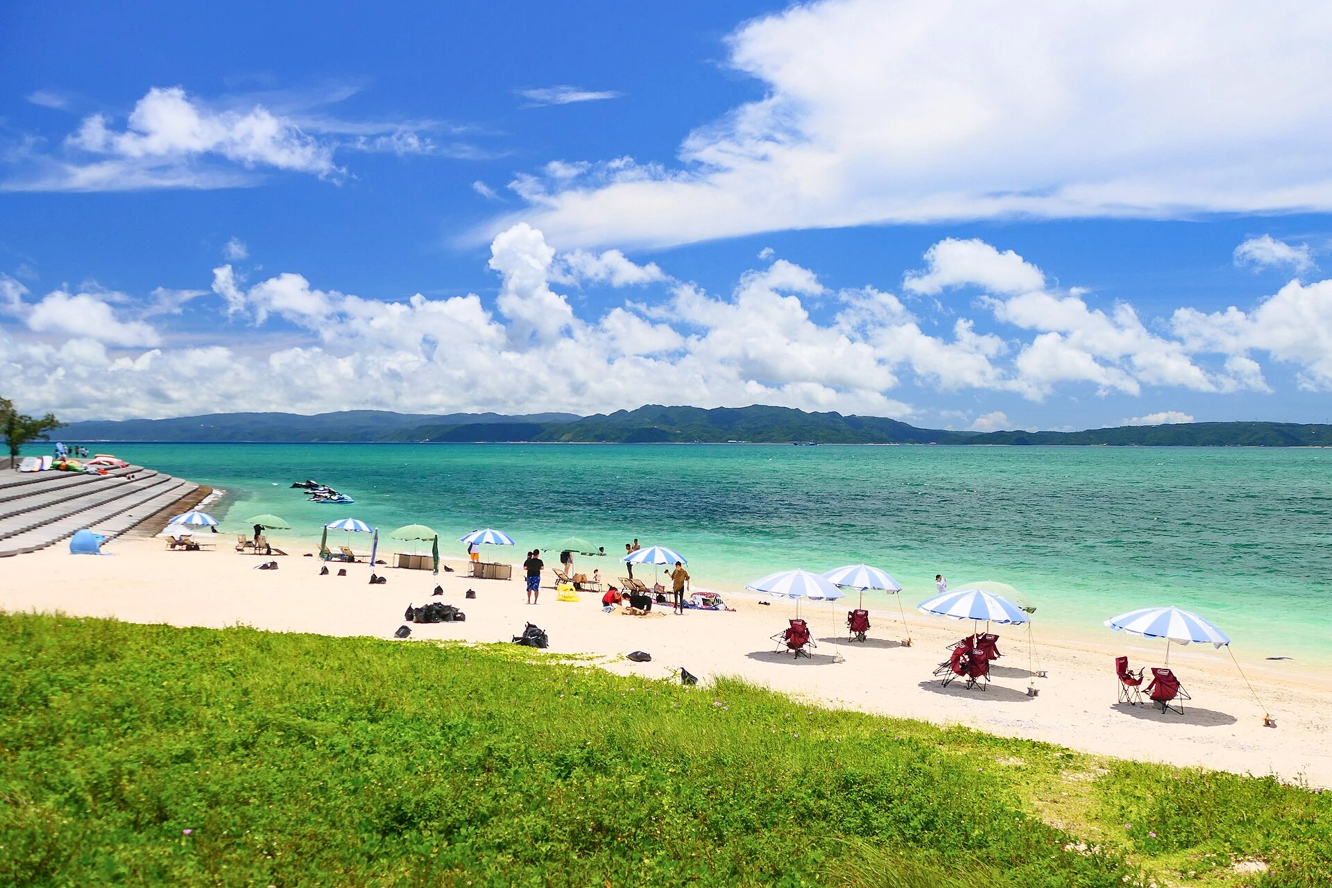
For facilities, the Nakijin Tourism Association’s village guide points Kouri Beach visitors to Sorahashi for toilets and showers. Ask about current availability, charges and operating times before planning to change clothes there. A beach walk and a swim require different preparation.
Tinu Beach and Heart Rock: a separate north-coast visit
Tinu Beach, sometimes spelled Teenu Beach, is where you find the two formations known as Heart Rock. The shape you see changes with your position and the water around the rocks. Give yourself time to look from the shore rather than treating one precise photograph as the purpose of the whole visit.
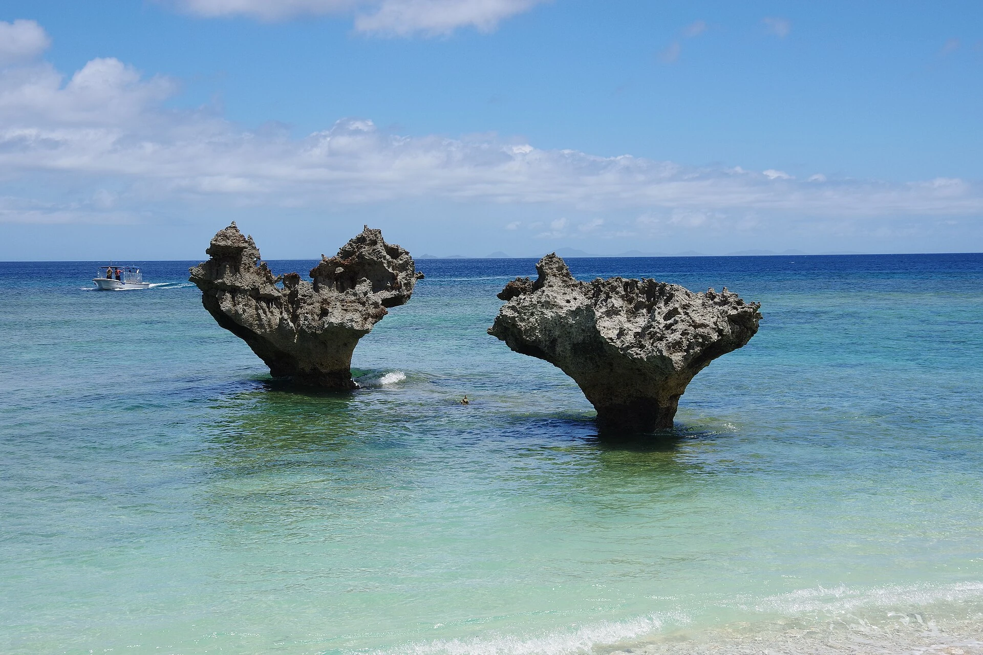
The northern beach access involves a separate walk from the road or parking area. Wear shoes suitable for the approach and keep the meeting location saved. For someone who needs a level route, ask about current access before committing to the walk; the bridge-side area may be a more comfortable alternative.
Tokei Beach: rock formations and a natural coastline
Tokei Beach is another north-coast choice. The official destination guide identifies the unusual rock formations around Tokei and Tinu, including circular holes in the rocks. Choose Tokei if observing the coastline interests you, and allow for the approach as well as the time on the shore.
Keep a flexible itinerary here. Looking at the shore from an accessible point can be enough; there is no need to climb onto rocks or approach breaking waves for a better angle. Private land, ropes and local access signs take precedence over an old route description.
Peace Beach and quieter coves: decide what you need first
The official Okinawa guide groups Peace Beach with the northern beaches that lack facilities and lifeguards. A quieter shore can suit a short landscape stop, while a family needing toilets, changing facilities or a supervised swim has different requirements. “Quiet” should not be used as a substitute for checking those needs.
Swimming and beach facilities: check the actual beach
The northern beaches are places to appreciate the scenery. Okinawa’s official sea-safety guide advises visitors to swim at beaches with lifeguards and use designated swimming areas. Follow local restrictions and current conditions, and choose a supervised beach or a suitable professional activity provider if swimming is the main goal.
Check the return bus or meeting time before walking down to a cove. Carry water, take rubbish back with you and leave shells and wildlife where you find them. If the coast is closed or rough, change the plan.
Kouri Ocean Tower: opening hours, admission and the visitor route
Ocean Tower provides the elevated view many visitors associate with Kouri. The operator’s tower guide describes indoor viewing floors, an outdoor ocean deck and a cart ride through the grounds. The quoted 82 metres refers to elevation above sea level, rather than the building’s height.
Current standard prices and hours
The Japanese facility page lists the following standard information, checked on October 16, 2026. Use current notices alongside it; parts of the English page still display older seasonal schedules.
| Item | Published standard information |
|---|---|
| Opening hours | 10:00–18:00; last admission 17:30. |
| Adult admission, age 16 and over | ¥1,000. |
| Child admission, ages 6–15 | ¥500. |
| Children under six | Free under the operator’s published rules. |
| Address | 538 Kouri, Nakijin Village. |
| Closures | Normally open daily; severe weather can change operations. |
For two adults and a child aged 6–15, standard admission totals ¥2,500. Food, transport and optional purchases are separate. Online packages may include a drink or sweets, so compare the inclusions before comparing the price.
Allow time for the museum and the viewpoint
Our suggested tower block is 60–90 minutes, with more time for a meal. That is an editorial allowance, rather than a promised queue or visit duration. Arriving close to last entry gives you less flexibility for the full route.
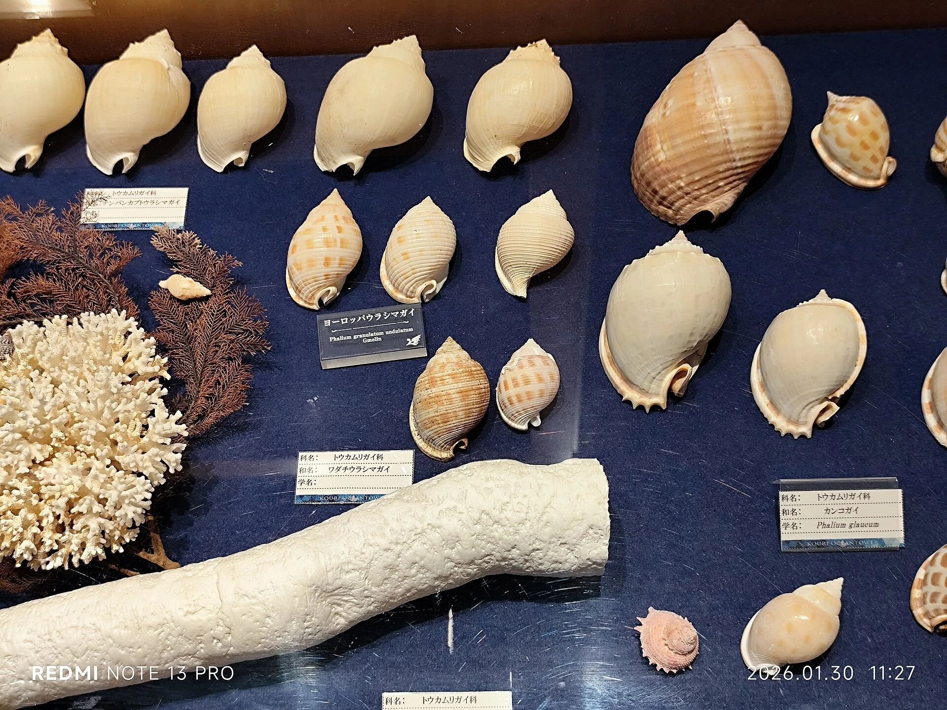
The operator’s museum page introduces its seashell collection. This gives the visit an indoor element, but the quality of the outdoor panorama still depends on the weather. Check whether the rooftop is operating if that is your priority.
Steps, transfers and the rooftop
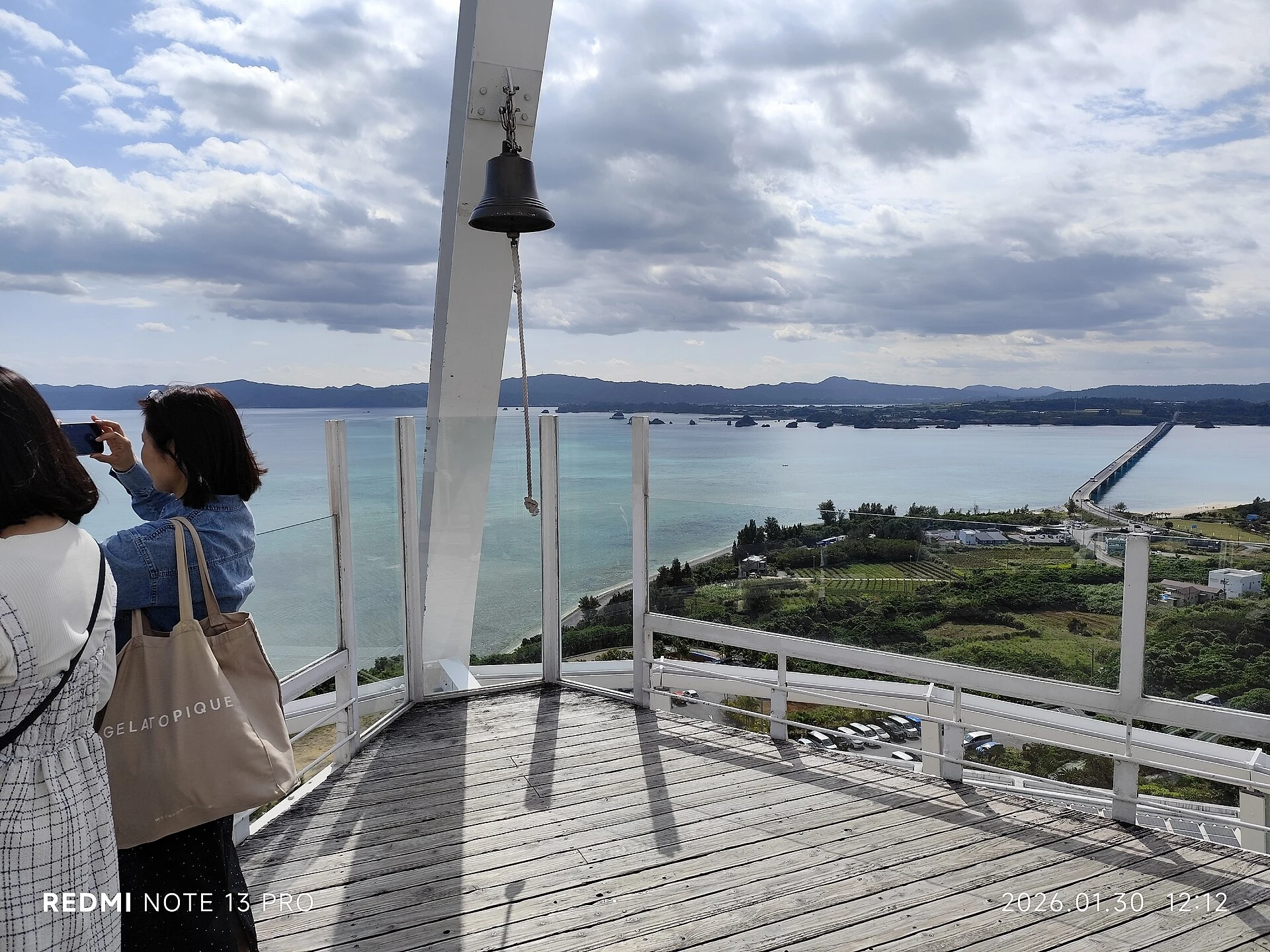
The facility FAQ identifies a transfer when boarding the cart and stairs to the rooftop; it describes the other areas as barrier-free. Contact the operator about your own mobility requirements, rather than treating the whole attraction as one step-free route.
The attraction’s carts run within its grounds. They are not vehicles you can rent for travelling to Heart Rock or around the island.
Getting to Kouri Island from Naha: car, private driver, bus or tour
Driving and a private driver
Ocean Tower’s official access page gives approximately 1½–2 hours from Naha using the expressways. This is a reference journey to the attraction. Your hotel location, traffic, breaks and chosen route can change it substantially.
A rental car suits travellers who want to set their own pace and are comfortable driving. A private driver can make sense when your group prefers to travel together, needs specific pick-ups or wants to agree a route with several distinct stops. For either option, allow a full day from Naha when adding a proper island visit and lunch.
If you are staying in Onna, supply the exact hotel rather than using a Naha estimate. An island visit from a northern hotel can also be planned differently from one that requires a long journey back to Naha that evening.
The current local bus route reaches Kouri
Yanbaru Express operates the Three Islands Line, connecting with its Airport Line at Nakijin Village Office. The operator’s timetable revised November 1, 2025 includes Kourijima-no-Eki Sorahashi, Tokeihama / Heart Rock and Kouri Ocean Tower. Some older visitor pages describe only a bus to Yagaji followed by a long walk; use the bus operator’s current information for this decision.
- Plan the northbound connection. Find the Airport Line service from your actual Naha stop and its connection at Nakijin Village Office.
- Choose the island stops. Read the Three Islands Line table in the correct direction and distinguish daily services from weekday-only services.
- Plan the return before adding stops. Check the island departure, onward connection and final stop near your hotel. Keep time for walking back to the stop.
Check what the Kouri Pass covers
The same operator timetable lists a one-day Kouri Pass at ¥1,000. It covers the Three Islands Line and the Airport Line section between Nakijin Castle Ruins and Nakijin Village Office. The journey from Naha is outside that local coverage. Compare the pass with individual fares for the trips you will actually make, and check current purchase and use conditions with the operator.
For a wider comparison of buses, hotel bases and tours, see our Okinawa without a car guide. Bus timetables can change, and a convenient outward journey does not establish a convenient return.
When a sightseeing tour is the simpler choice
A group tour can solve the long-distance transport, but compare the exact Kouri stop, time there, departure point and guide language. An English booking page does not establish that the guide speaks English. Ask whether the option includes the tower, Heart Rock or only the bridge-side area, and whether admission and lunch are included.
For a tailored route, send OkinawaVia your hotel, date, group size and priority Kouri stops. Ask for a vehicle suitable for your passengers and luggage, the service hours, total quote and language arrangements. Our private driver guide explains what to confirm before booking.
Where to pause for lunch or a drink on Kouri Island
Sorahashi near the bridge
Kourijima-no-Eki Sorahashi brings together food outlets, local produce, refreshments and visitor information near the bridge-side area. It is a useful place to plan a practical break rather than continuing around the island hungry and hoping to find an open kitchen.
The operator advertises 09:00–19:00 for the facility. Individual outlets and meal service have their own schedules, so check those separately. Its website introduces Okinawan soba and several snack and drink businesses; use the current menus to decide what suits your party.
The Okinawa tourism listing describes visitor information, a food court, parking and family facilities. When using parking, follow the signs and any current conditions for the particular area you enter.
A longer break at Ocean Tower
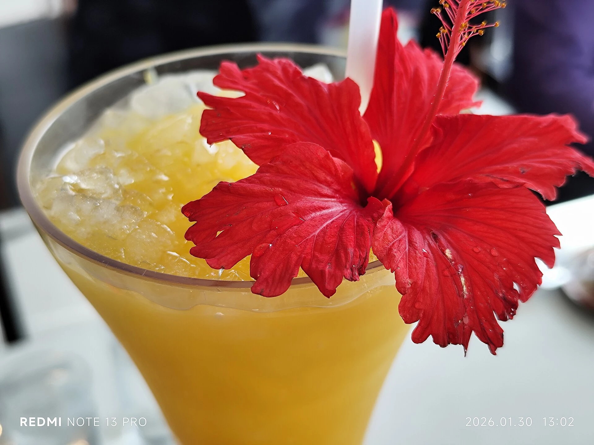
If you prefer to sit down during the tower visit, consult the operator’s restaurant information before arranging your afternoon. Leave meal time outside your sightseeing allowance, especially when your return depends on a specific bus.
For dietary requirements or allergies, ask the restaurant directly before choosing a dish. Confirm the ingredients, preparation and available alternatives; photographs and an English dish name are not enough to establish suitability. Carry drinking water and allow a simple backup meal if your first choice is busy or closed.
Kouri Island day-trip routes: a short stop or a northern Okinawa day
Choose one of these starting plans, then adjust it to your hotel, transport and interests. They are editorial route suggestions, without guaranteed drive times or attraction availability.
| Route idea | Suggested sequence | Best fit |
|---|---|---|
| Bridge and beach introduction | Cross the bridge → Kouri Beach walk → refreshments → continue your northern route. | A 60–90-minute stop when you have a different main attraction. |
| Kouri as the main destination | Beach area → tower and museum → lunch → Heart Rock → return. | About 3–4 hours on the island, with connections and driving added separately. |
| Aquarium with a short Kouri stop | Churaumi Aquarium as the main visit → bridge and beach → hotel. | A full day with a shorter island visit and a flexible meal stop. |
| Northern base, slower pace | Start from your northern accommodation → selected Kouri stops → optional Warumi viewpoint → return. | Travellers who want to avoid spending most of the day travelling from and back to Naha. |
Combining Kouri with Churaumi Aquarium
The two destinations can fit into one northern day, but decide which deserves most of your time. The tower operator gives roughly 25–30 minutes between the aquarium and its attraction across its access and FAQ pages. Treat that as a driving reference; parking, traffic and walking still need their own allowance.
If the aquarium is the priority, keep Kouri to the beach and bridge area. If Heart Rock and the tower are essential, consider a separate island visit instead of adding every stop to an already full aquarium day. Our Churaumi Aquarium guide covers admission, programmes and time inside, while the three-day Okinawa itinerary helps place the north within a longer trip.
Warumi as an optional approach or return stop
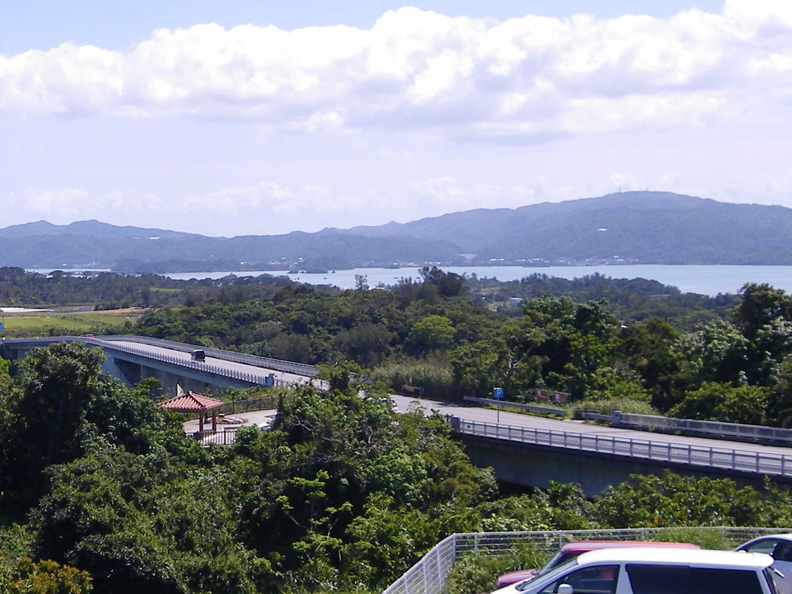
Warumi offers a different landscape around the approach through northern Okinawa. It is useful to recognise the name when reading a route or bus timetable. Add a viewpoint only if its current access, opening conditions and location fit the way you are travelling; it is an optional part of the day.
A hotel transfer, an airport transfer and a sightseeing charter are different arrangements. If luggage or a flight is involved, tell the operator before agreeing a route. See our Naha Airport transfer guide for the details needed when arranging an airport journey.
Weather, children and the checks that make the day easier
Choose the day for the activity you care about
For landscape photography, look at the forecast and keep some flexibility in your northern days. For swimming or a marine activity, the operator’s conditions and beach restrictions matter more than the appearance of the sky. During severe weather, follow closure notices and change the route rather than going to an exposed shore.
A coastal stop can still be enjoyable outside the main swimming season. Plan for wind on the viewpoints and suitable footwear for the shore. Keep a meal or indoor visit available as a practical alternative, while recognising that the tower can also close or restrict its outdoor areas.
Plan around the least comfortable part of the route
For children, older travellers or anyone who needs regular breaks, check the walking approach, toilets and steps at each stop. A comfortable vehicle does not establish accessible beach access. Ask for specific information about transfers and surfaces, and agree where your group will meet again.
- Save the hotel address, each attraction and the actual meeting or bus-stop location.
- Pick the essential stop first, then mark optional stops that can be dropped.
- Check current tower notices, restaurant hours and return transport.
- Bring water, sun protection, suitable footwear and a way to keep belongings dry.
- Keep useful tickets, route information and contact details available offline.
- For a private journey, confirm passenger and luggage capacity, child-seat needs, service hours and the full quote.
If your group would benefit from a planned route, request a Kouri Island itinerary and quote with your travel date and hotel. English-speaking drivers and particular vehicle requirements should be requested and confirmed in advance. An enquiry begins the discussion; it does not confirm a reservation.
Kouri Island FAQ
Is Kouri Island worth visiting?
It is a good fit if you enjoy coastal scenery, beach walks and viewpoints. From Naha, consider the journey alongside the visit. A brief bridge stop may be enough within a larger northern itinerary; give the island longer if the tower and Heart Rock are priorities.
How long do you need on Kouri Island?
Our starting allowance is 60–90 minutes for the bridge-side beach area, or 3–4 hours for a fuller visit with the tower, a north-coast stop and a meal. Add your hotel journey, traffic and bus connections separately.
Can you visit Kouri Island without a car?
Yes. The current Yanbaru Express Three Islands Line serves Sorahashi, Tokeihama / Heart Rock and Ocean Tower, with an Airport Line connection at Nakijin Village Office. Plan the return timetable as carefully as the outward journey. A group tour or private driver is another option.
Is Kouri Bridge the same place as Heart Rock?
No. The bridge enters the island from the south; Heart Rock is at Tinu Beach on the north coast. Save separate map pins and include travel and walking time between them.
Does the Kouri Pass include the bus from Naha Airport?
The published local pass covers the Three Islands Line and only a short Airport Line section between Nakijin Castle Ruins and Nakijin Village Office. The Naha Airport journey is outside that coverage. Verify current fares and conditions with Yanbaru Express.
Can you swim at every Kouri Island beach?
Choose a designated, supervised swimming area and follow current restrictions. The official Okinawa guide identifies northern beaches without lifeguards or facilities; appreciate those shores as scenery rather than assuming they are suitable swimming spots.
Can Kouri Island and Churaumi Aquarium fit into one day?
A focused combination is possible by choosing one main visit and keeping the other shorter. A full aquarium visit, tower, multiple beaches and a long lunch need more time. Agree the route against your start point and return requirements.
ABOUT THIS GUIDE
Prepared by OkinawaVia for English-speaking travellers planning a visit to Kouri Island. Practical sources checked October 16, 2026. Visit allowances and route suggestions are editorial estimates, without a claim of personal participation. Transport, opening information and access can change; confirm with the relevant operator before travel.
Sources are linked beside the relevant information. For general orientation, see JNTO’s Kouri Island introduction, Nakijin Tourism Association and the current operator pages linked above. The cart belongs to Ocean Tower; photographs of the attraction do not depict OkinawaVia vehicles or staff. Photo sources, authors, licences and adaptations appear in the captions.